
This page is dedicated to a collection of linux programs developped to achieve fast, high quality, and semi-automatized structured grid generation and pre-processing
Structured land/sea mask flag : automatic construction from shorelines database
Bathymetry terrain model are often inappropriate to generate proper land/sea mask flag setting. The most secured way to perform this operation consists in creating a prior (closed) polygons set from which inside/outside detecting algorithm can built the land/sea flag. However this can be a tedious effort, especially in highly complex coastal areas. The grid generation and pre-processing software has been upgraded to automatically extract shorelines in the structured grid frame, filter details to a level consistent with the local grid resolution, eliminate unnecessary limits (inland lakes, etc…), and produce the consequent land/sea flag on grid (stored in a CF compliant netcdf file). The limits set (built as closed polygons) is also stored in a ASCII file, and can be easily edited to correct mis-formed limits.

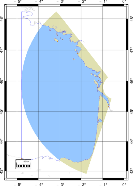
Bay of Biscay polar grid example (courtesy of N. Ayoub, LEGOS)
Ocean mask in blue, continental mask in brown.
GSHHS original shorelines (gray lines), land/sea limits (blue lines).
For interactive graphical editing and plotting, see Genesis/xscan page.